首頁我是相片相簿文字
snDateCommentHit
Display 1-20, Total 50 data, 2024-04-24
page 123
Place Report development2016-09-27


Place.Report development
URL->https://place.report/

1. Website statement:
1. Place.Report is a Google Map API application which helps Sales to identify possible local customers.
2. Place.Report was an idea came out while developing the StreetView.cc website, both websites apply the same algorithm but pick up different target audiences.

--
2. Release Note
First released on 9/27, 2016 v2.0 (from streetview v1.3)
a. Functions:
[Public] Target Area Search, Store Search, Place.Report
[Priviate] MyPlaces, Place.Rank

b. Support Countries:
US, United States
TW, Taiwan

c. Target Audiences:
Sales: door-to-door, telephone
Marketing company
Local store owners

d. Keywords:
Geomarketing, Store Research, Marketing ROI measurement

--
3. Bug Report / Discussion
Please leave a comment below if there was an issue or anything you would like to discuss
IP 全球地理位置資料庫開發日誌2016-09-06

IP 全球地理位置資料庫開發日誌

話說從頭, 這是中文式流水帳。
開發的綠起是為了把 streetview.cc 的入口寫的完美一些,
所以在網路上找了些免費的 IP 資料庫來使用,
想利用 IP 來定位 Google Maps 的起始位置。

開始先找到的是 MaxMind 的 GeoLite2 (GeoIP2免費版),
接著就花了點時間把將近三百萬筆資料寫進 MySql 裡,
接著隨機性的測試一下, 還可以哇!!
然後發現怎麼故鄉台灣的IP都只能定位到陳有蘭溪??

稍稍研究之後, 原來似乎還沒有人把台灣的IP區段給補完, (人才都跑那去了?)
也許警政或調查機關有, 不過我沒有找到就是了~~
最接近的就是 IPIP.net 的創辦人高先生在今年初時自己的微博說:
「 嗯,就在刚才,已经把手里的台湾的IP 库地级市和区县库数据都搞定了,貌似这个是全球独一份吧?台湾本地公司都没有。。」

哇, 牛人說牛話了, 於是我花了點時間在 IPIP.net 上撈了一份 17monipdb 做再開發。

只是 17monipdb 可能是免費的關係, 數據上有些許錯誤,
不過對於鑑別中國IP的地理應該還是可以的,
所以我就花了點時間把 17monipdb的結果(中國) 整合到 GeoLite2 之中。

然而, 這並沒有解決陳有蘭溪的問題。

我又把念頭放到再來轉個資料庫看看, 查了查。決定就是你了!!
IP2LOcatION 上吧!! (其實真沒有幾家有開源的)
抓回來一看, 天啊!! 4百多萬筆資料啊!!
不過有了匯入 GeoIP2 的經驗, 不怕不怕。
花了些時間等待匯入資料庫後, 交叉比對目前這兩大開源的資料庫如下:


從上表可知, IP2LOcatION 對於IP表切得較細, 不過對於地理地址定位來說, GeoIP2 的比較齊全,
另外IP2LOcatION是只有一張資料表, 在執行上的效率較差, GeoIP2是兩張表格, 效率較好。
理想的作法應該是採用 GeoIP2 的資料結構, 補上 IP2LOcatION 的有效資料。

雖然這樣能解決陳有蘭溪的問題, 不過我得回頭做別的事了。

目前的作法是把IP2LOcatION列為參考資料, 待有空或是有想法時再將兩個資料庫整合再一起囉。
未來的開發的意向大概就是把兩個資料庫截長補短, 然後整合進一個台灣的IP區段, 為家鄉盡一份心力;
然後再加上 Google Maps 的定位去自動資料庫的校正和補充。就算大功告成啦~

現就以此文將此開發暫告一段落; 我得來繼續寫 streetview.cc 大數據!!

--
IP GeoLocation Service2016-08-29


IP GeoLocation Service development 中文版

http://ip.ymc2.com/
Website statement:
1. The ip.ymc2.com is a customized website for IP query purpose.
--
V1.3 Released on 9/6, 2016
1. Include a reference DB from ip2location.com, DB11 LITE
2. Optimize MySQL commands to shorten query time
3. Minor texts fixed.

V1.2 Released on 9/4, 2016
1. Include 17monipdb.dat (Open-Source Database of CHINA IP) to better locate location in China
2. Enable to display city name in both Chinese and English (CHINA only)

V1.1 Released on 8/30, 2016
1. Support Country-CountryName. US-> United States
2. Apply Country - Language- GoogleMaps look-up to set default on Google Maps UI

V1.0 Released on 8/29, 2016

Function: Giving an IP address, return its GeoLocation including City, Country and Latitude & Longitude. (and maybe other information as well)

Support: IPV4 format only.

API usage: Provide JSON result, but only for internal usage now.

Database & Tables :
1. GeoIP2
Version: 20160802 open-source
Max Note: 804,007 geo-location data, and 2,180,870 ip-blocks data were imported.
This product includes GeoLite2 data created by MaxMind, available from http://www.maxmind.com

2. IP2LOcatION LITE-DB11
Version: 20160901 open-source
Max Note: 4,016,410 data were imported.
This site or product includes IP2Location LITE data available from http://www.ip2location.com

3. 17monipdb:
Version: FREE 20160601
Max Note: This db is mainly to locate specific IP-address where $country=CN. Total 96,817 data were imported. (225 duplicate values on row startIpNum row; 2 duplicate values on row EndIpNum. Unable to setup primary key.)
The API includes 17monipdb.dat, 作者©高春辉, available from https://www.ipip.net/download.html


4. GoogleMaps Languages Support list: GMap-language.csv, source-> https://developers.google.com/maps/faq#languagesupport

5. a revised Country codes (ISO 3166) and official language table: country-language.csv, source-> http://download.geonames.org/export/dump/countryInfo.txt

6. a table to look-up locId with city name in Chinese and in English (China IP only) locId-cn_city.csv
Max Note: Please open it with Notepad before importing to your db. It includes Chinese characters.

--
Report Error: Please leave a comment below if there was an error result.
Pokemon Go 新手教程與攻略2016-07-13
Pokemon Go 新手教程與攻略

麥大叔收集美國鄉民的情報, 整理Pokemon GO的相關教程與攻略如下, 希望對你有幫助。
本文最上面是快速導覽功能。堪誤請留言, 謝謝

» Read More
StreetView.cc Development Diary2016-03-15

Streetview.cc Development Diary

Kind of a note to memorize something that I may forget in few days after....


Ver 2.1 Released:

Public
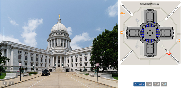
StreetView: Display places with Google See-Inside features.
Coverage: Reveal areas which have been scanned by system.
SeeInside: SeeInside a place with the UI combines Google Maps(pegman) and its StreetView image on the same page.

Private
SECRETS

Website Version
2016/10/07 - Ver 2.1 Released. all major function revised.

2016S2S3 - Development https://Place.Report website
2016/4/13 - Revise See-Inside judgement programming (v1.1)
2016/4/12 - Comment_Service implemented
2016/4/01 - Ver 1.3 Released. mysqli implemented
2016/3/25 - Ver 1.2 Released. New function: MapScan, Providing Linear and area two types scanning.
2016/3/22 - Website Automation Test Success!!
2016/3/17 - Improve processing efficiency by using curl instead of file_get_contents
2016/3/15 - Big-Data Place Report trial. (providing Place Ranks)
2016/3/12 - Ver 1.1 Released. New functions: Coverage, PlaceRank, SeeInside
2016/3/12 - Integrated g.ymc2.com, an URL Shorten API. a JSON application
2016/3/10 - Ver 1.0 released to DOMAIN: streetview.cc HOST: netfirms.com
Function: Home, OnePageReport, PlaceSearch, MapProcess
2016/3/01 Defined three modules, placeid, cid and cbk, to figure out if a store has the SEE-INSIDE feature or not.
2016/2/15 Start Coding .........A Google Maps Javascript V3 Journey....
--
Problems/Issues/Improvements Ideas 2.1:
1. CSS Layout for mobile device. TBH, i don't really care about this for sure.
2. Google API limitation. a Major concerns
3. Facebook Graph API

Update Place.DB (Automatic and Manual)
Define a mid-term relationship for Place.DB and Seeing.DB (maybe a Pano.DB)?
Useful Statistic Data
Replace mysql to my_sqli sentence
Rethink the function: judge_seeinside, judgement see-inside...
Implement google analytic
IP rule for certain function

--
Major Fixed:
1. How to process place results generated by Google Maps API (Async) to db?
-> 1) generate a click button within the async function.
-> 2) generate an auto-run php page.

2. How to curl the place results generated by Google Maps API (async) to a html.element?
-> 1) Curl does not work on async page. (empty element)
-> 2) Include the Google Maps API script on the parent page

3. Improve server efficiency:
-> A test reveals that curl is 50 percent faster than file_get_contents.
-> Replace file_get_contents with curl function.

4. Website automation test solution:
-> Tried Selenium webdriver, but was unable to figure out a way to make it work on wamp server.
-> Tried Selenium IDE, Works, however it had file size limits for processing codes(20KB?), and also there was no flow control (if-else) at the moment for testing purpose.
-> Turned out a solution which is to connect the server with localhost, and write php pages to the server via fopen(ftp), and then automatically run these pages to process results.

5. Encode the imgurl of all pano:
-> Applied JSON to communicate with g.ymc2.com (url shorten service)

6. fopen($ftp_path): failed to open stream at certain time ?
-> It seems like the hosting server issue (connection error or what?)
-> Use curl to do ftp method. (not sure if doing this is right, but it temporally works!)

7. The owner-response-rate (Google Reviews)
-> Find the recent 10 reviews and check to see if response from the owner exists
Google Street View Image API 心得2016-02-10
最近開始研究 Google Map 的一些API應用,

首先, 下圖是用 iframe 包圍的一張全景圖
位置接近於
緯度 45.832617
經度 6.8651769
朝向15.44度方向
視角是-5度 (朝下)
視野是100度


而根據以上這些數據, 就可以呼叫 Google Street View Image API 取出影像


呼叫方式 https://maps.googleapis.com/maps/api/streetview?參數
參數包括:
size: 長x寬 (影像大小)
location:經度,緯度 (影像位置)
fov: 20-120 (視野大小)
heading: 0-360 (方位)
pitch:-90-90 (視線角度)

根據 Google 官方文件 提到, 用 location 這個參數做定位時, 會找到最接近點的全景圖, 所以有不確定性。
建議是採用pano id的方式去做定位。
只不過 pano id要怎麼呼叫我查了老半天還是看不太懂, 先暫時寫到這裡, 後續有發現在補完。

= 2016 02.16 補充 =
pano id 的呼叫方式:
pano: #panoid
sensor: false (可忽略 App Key)

Street View | Trusted Photographer2015-08-22
Street View Trusted | Trusted Photographer

Do you want to apply the Google Street View technology to show your business to the world? Try below sample:

Jade Mountain Café
2611 E Johnson St, Madison, WI 53704

Ting-Li Lin and Max Chen (myself), who founded Snowforst.co, are helping Wisconsin local business to spread their visibility! Although they are both Google Trusted Photographers, their photography capabilities is way beyond than this.

I am currently marketing Google Street View services in most towns in Sauk county, like: Sauk City, Baraboo, Reedsburg and Wisconsin Dells area. If you see me stop by your business store, don't be surprised. I see your potential and would like to help promote your store. I believe Street View for business is a great marketing tool for local business for the below reasons:

» Read More
Max Chen2015-08-01

>> 中文版

Hey~ Nice to meet you~

I'm Max Chen <u870820@gmail.com>, an engineer, backpacker, photographer, web programmer, and blogger.

I have an M.S in Industrial System Engineering from UW-Madison, and I've worked at ASUSTek Inc., PEGATRON corp., and now Hankscraft Inc.. In the past, I did research in the UW-Madison Naturalistic Decision Making and Simulation Lab with Dr. Douglas Wiegmann , and at the Waisman Center. My research interests were focused on User Experience, Aviation Safety and Patient Safety.

I am a professional in project management and quality engineering, and I enjoy working on "complex problem" projects with hard to identify root causes or projects involving with cross-functional teams. I make a living by utilizing my knowledge and experience in both the quality and manufacturing fields. I am also a certified six sigma black belt of the American Society for Quality.

I was born in Taipei, Taiwan, and I have lived in Prague, Czech for 2 years, Shanghai, China for 3 years, and I now live in Madison, Wisconsin. Traveling and seeing the world is what brings excitement to me in life. While traveling I found a passion for photography. Taking photos and sharing what I have seen has become my treasure. In 2003 I launched a blog to present my photography.

In my free time, I like to do web programming. After not finding a photo album service I liked, I decided to code on for myself, it is called Max Chen Photo Database. It was just a start, my other web application could be found here(mandarin). In addition, my latest web project isPlace.Report which utilized Google Maps API and Facebook Graph API, a data-mining informative service.

In mid 2015, I started a new adventure with Ting-Li Lin. We set up Snowforest, a company specialzing in architecture photography and beyond. Snowforest's mission is to deliver artful images and to ensure every customer is satisfied. Snowforest is a new challenge and a new chance to us, and I devote myself in it and like to picture a wonderful future with it.

In my leisure time, I enjoy swimming, running, reading, watching movies, and playing games. I am not good at writing, but I will try my best to record thoughts, studies, and stories in here. I would like to share my life experiences with my friends and future generations. Someday, we will become someones' memory, and here is the best place to remember me.

Below is a list of social medias I am using. Let's exchange our thoughts via:

twittertwitter

twitterfacebook: mandarin

Edited by Max Chen on Oct 10, 2016. Thank you Tara for proof reading.


Max and his camera.
Max was waiting to take a sunset


Max in Grand Canyon.

Tingli and I were at Grand Teton
Max and Tingli were at Grand Teton.

Why Realtors need a floor plan2015-07-29

A floor plan makes your real estate listing unique


As a successful Realtor, you may already know how important the listing photos could help you in attracting buyers’ eyes, and make them move to you. It is no longer a secret in the real estate market. But, do you ever see a floor plan was included in an MLS website? Rarely. I would say only 1 out of 500 listings would have a floor plan. Frankly speaking, expense to create a floor plan is the reason that why a Realtor could not be able to provide one, although, according to Realtors.com, there are still over than 80% of home buyers would like to have a floor plan of those interested properties on hand, and would love to see an interactive floor plan with little icons with pop-up photos. Luckily, if you are the Realtors in south central Wisconsin, your problem is solved. As a professional engineer, I am able to create relatively precise floor plans with a low cost at $99 (per floor or 1,600sqft) that can be included in your listing material. Follow up, let me tell you how a floor plan could effectively increase your selling power.


On an open-house day


Printed floor plan will be a very impressive handout for home buyers on an open-house day. A buyer may consider much more than you thought. He may think about where to relocate his piano or fitness equipment, or is he able to move his large items to the basement? What dimension is the kitchen? What width is the hallway or the stair? All these kind of questions reveals that why a floor plan on hand will be helpful. By answering these questions with a precise dimension, will definitely reveal your professionals. People will be impressed by you. Moreover, buyers with a floor plan can explore the home on their own. Just figuring it like exploring a corn maze in your childhood. It can provide a unique customer experience for quiet customers. After the open-house event, people will remember the property because you were the one who hand them a specific floor plan other than a brochure, and then, you will be picked up. This counts for everything.


Interactive floor plan


Buyers are not able to picture the layout of a property if photos are the only content provided. Beautiful and bright photos have become a standard marketing tool in this market, so you must create an unusual user experience on the internet to help you market a property. Providing a visual tour with slideshows and videos is an option, but do you know that most visual tour services are outdated. Nowadays, people tend to use mobile devices to surfing on the internet even when they are at home. This is also a reason that why as a Realtor need to reconsider about implementing an interactive floor plan on their website. Just browse your visual tour service with your mobile device, and compare it with ours here. The snowforest.co interactive floor plan embed with photos is the best among all visual tour services. Prospective buyers will be able to know where and what this photo was taken, and it help them to build up a visual sense of a whole property, and then the most important of all, the interactive floor plan bring buyers to you.


Again, why do you Realtors need a floor plan? Is it worth to invest? An analysis done by Redfin Corp., a Seattle-based brokerage, indicated that listing better photos is worth than $1,000 or more. There is no official study that tells you how a floor plan will be worth at, however, being able to provide a mobile friendly visual tour and help home buyers to decide whether to keep or eliminate a property on their “wish-to-see-list”. If a virtual tour service, such as snowforest.co, has done very well, it is much more likely that the property will be kept in the list, and you will be called. This way develops a positive cycle, not only buyers and you will be able to save tons of time, and benefit you in multi-ways, including customer sanctification, website statistics and average time in the sell. So, why not include a floor plan in your marketing material?


100308-100325周記2010-04-04


Weekly Shots, 100308-100325

這陣子重溫一些文學作品, 看了幾部有深度的電影, 人生似乎是愈來愈有趣了。

然後鄭先生就來催稿囉! 所以就來很快速的 review 這陣子的 idea~

(跳轉接18張相片)

» Read More
091110-091116 周記2009-11-22


Fly Badger

Weekly Shots, 091110-091116

這週麥大叔在弄一個 Presentation, 由於事關下學期的funding; 所以特別地認真啊!!

麥大叔的毛病就是一專注之後就忘了自己還有網站這回事 (泣), 連 rumors 都忘了更新 (哭).

Anyway, 迅速回顧一下這一週的歷程!!

基本上這周拍的都是研究的東東... 沒有什麼心情或感性的起伏 (再哭)

文末有附 好久不見 的麥式簡報

» Read More
Cesky Krumlov2009-06-17


Cesky Krumlov

Czech Republic, UNESCO, 27images

Equip: Canon EOS 300D, EF16-35L


Date: 2004年02月6日; 2004年03月07日


Album: Cesky Krumlov


[2009 Update]

Cesky Krumlov是捷克境內"非常非常"迷人的小鎮~

捷克朋友們幾乎一致推薦 Cesky Krumlov 為捷克境內必訪的第一景點。(第二才是Prague)

多年後重溫舊照, CK的美景歷歷如目, 彩繪塔還在眼前閃爍金黃色的太陽光影...

時間似乎在Cesky Krumlov 靜止了,

我說: 它是波西米亞最閃亮的一顆珍珠! 朋友, 你若有機會拜訪捷克。

布拉格可以不去, Cesky Krumlo 你一定得來!

» Read More
Canon Quality Issues2009-06-08
youcantcanon >> Thank to Wendy's logo.

Canon Quality Issues

I am tired of Canon's quality problems in DSLR, so I collect a List of quality issues made by Canon itself. If possible, please forward this article to concerned person.  I wish Canon's manager will feel embarrassed after reading.

佳能的品質問題實在很讓人頭痛, 身為一個終端的消費者, 我決定開一張 QA-品質異常單 給佳能,

請用任何方式轉發, 希望佳能的管理者看到之後會覺得臉紅

* All Images are searched from photo-related forums. I have added the Orignal URL to the Links, and if you concern my use of  image, please mail me. Thank you.  *

* 所有圖片皆取材於攝影相關論壇; 除提供原始連結外, 若您對圖片的使用有異議, 請來信告之. 感謝! *

» Read More
Nikon DSLR History2009-05-18
nikon_logo >> Nikon DSLR History

這一頁記錄 Nikon 數位單眼的發展史


`

~ 閱讀指南 ~

本頁詳細規格為參考 Nikon 原廠網站,

本文包含以下有兩種排序方式及內容。

1. By Marketing (依據產品定位)

→ 按照目前 N 家四階市場定位排序


2. By Chronology (依據發佈時間)

→ 依照發佈時間排序


3. References (參考資料)

4. Revised Notification (變更事項記載)

~

» Read More
[32_100] 找工作中2009-04-12
img_1079 >> thank to Vivienne

找工作中

啊嗚~~ 一個美好的週末就這麼讓我拋棄了!!

昨天是在研究教授的生辰八字與我合不合; 今天則打開 Student Job Center 的網頁 review 一下!

嗯嗯~ 突然眼睛一亮!!

有個和攝影間接相關的工作好吸引人啊! Oh My God!

» Read More
[31100] 留學申請總結2009-04-11
090411

留學申請總結

麥大叔一共申請兩個領域, 一個是管理博班; 另一個則是人因工程的博班!

管理博班很殘念的幾近全軍覆沒? 實在是太奇怪了!!

難道唸管理博不需要工作經驗嗎?? 我本還想來發揚儒家的管理哲學呢!!

不過人因工程就是小勝的盤面, 雖然景氣不好時常被用來當做沒有 funding 的理由,

後來經我一番反省, 的確! 自己也沒有強又有力的研究背景能說服教授給我錢~

anyway, 總結這次的人因博班申請過程供後人參考:

» Read More
[21_100] Google街景2009-04-01
japan_google_street_view_540x305

Google 街景

這個 Google 街景實在是一個非常酷的 Kill Application, 我實在是相見恨晚啊!!!

運用的技術原理很簡單, 就是找台可錄影有GPS的車子, 然後放到街上轉轉,

再把所有拍攝到的相片按照GPS記錄器放到 Google Map 上~ Done!

像是上圖就是啥咧? 就是 Google 街景車拍攝到的日本美少女外拍啦~

» Read More
小虎與小J2009-01-06


小虎與小J

簡單說, 就是兩隻小怪物....

» Read More
Ubuntu 8.10 PPTP server2008-12-18
ubuntu

Ubuntu 8.10 PPTP Server Installation

其實, 目的只是弄個VPN Server來做跳板, 卻沒想到花了我三天兩夜的腦力...

筆記供後人參考吧~

[背景]

SERVER: COMPAQ m700, (p3-700, 256M+64M, 30GB)

ISP: HINET 固定 IP

» Read More
SOP Revise2008-10-29
Private Content
page 123